
|
|
SUBSIM: The Web's #1 resource for all submarine & naval simulations since 1997
|
SUBSIM: The Web's #1 resource for all submarine & naval simulations since 1997 |
 06-15-22, 03:36 PM
|
#1 |
|
Lieutenant
 Join Date: Jun 2019
Posts: 256
Downloads: 542
Uploads: 0
|
Navigation Bathymetry Map 27.08.2022
1. The Archipelago of Saints Peter and Paul has been added to the map. 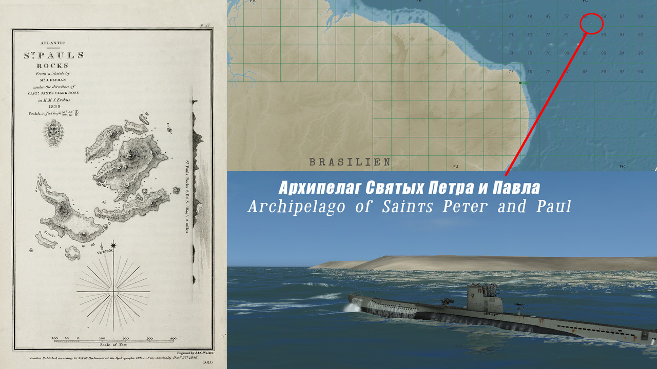 2. Orinoco and Amazon have been added to the map. 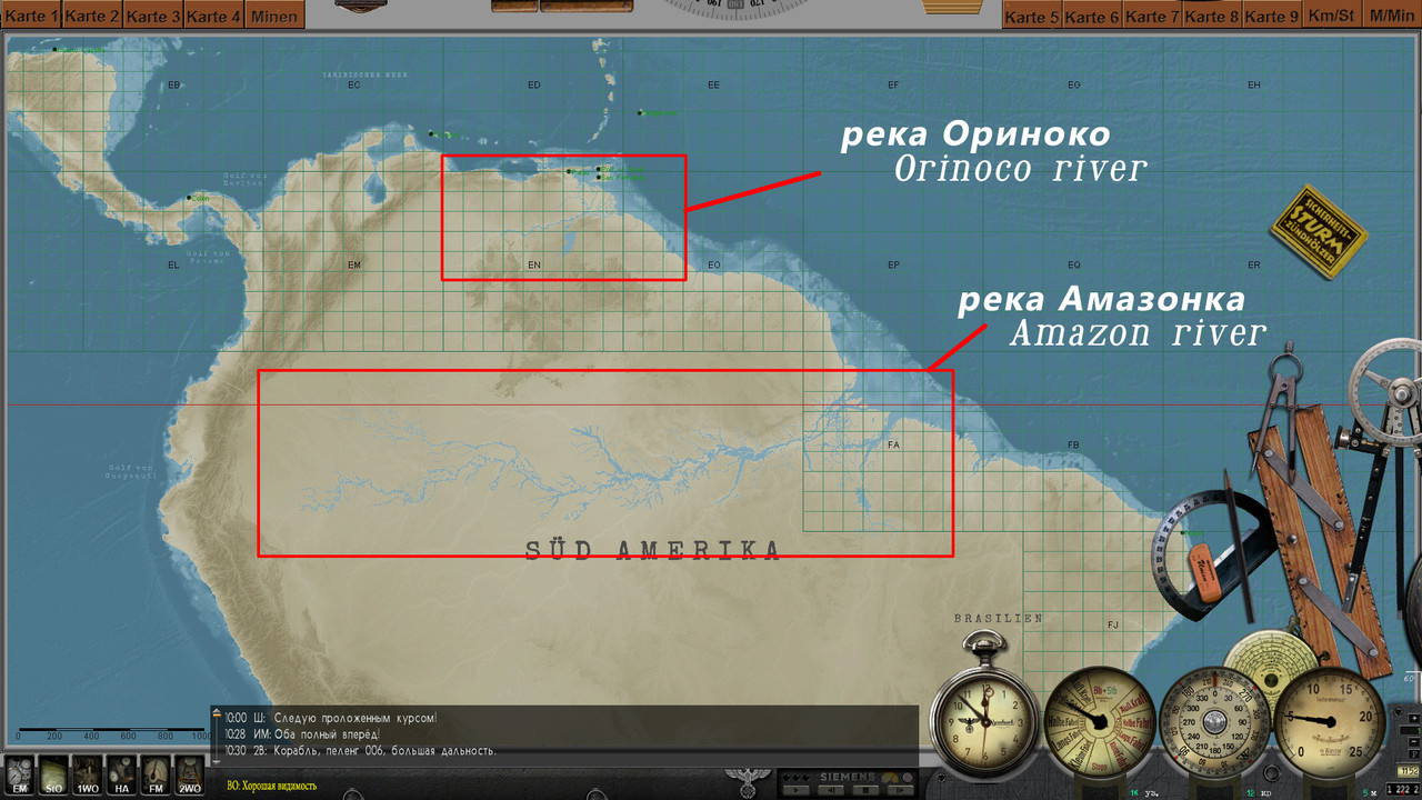 3. The River Thames has been added to the map. 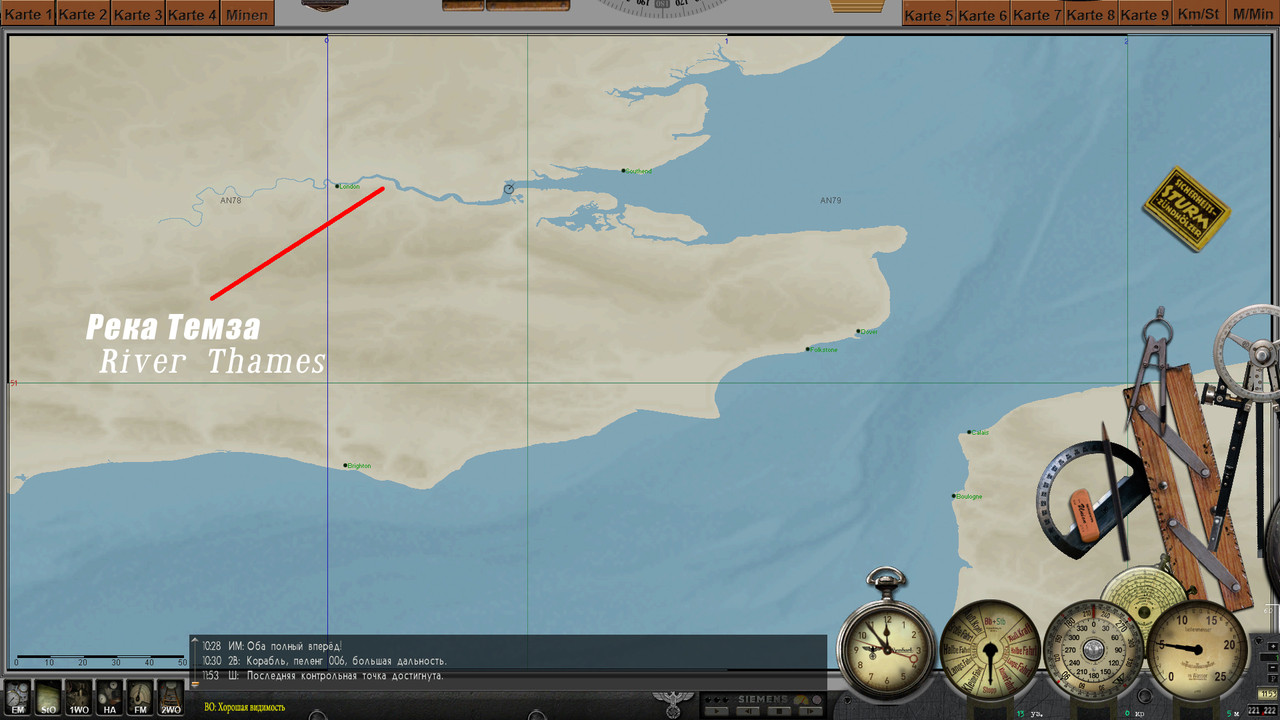 4. The island of Sula Sgeir has been added to the map, as well as the heights of the island of Rhone have been redone. 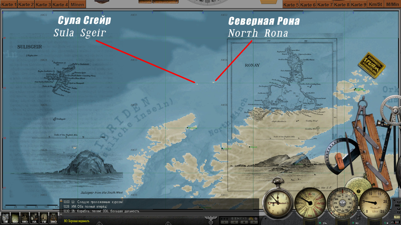 5. Tjeldoya Slott Skerry Pass has been redesigned. Reworked depths in the Narvik and Harstad areas. 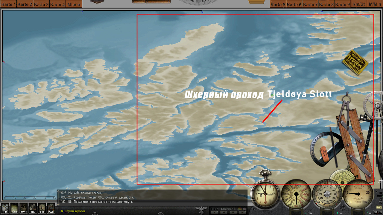 ----------------------------------------------------------- Navigation Bathymetry Map 2022 (Stock version Final) Download: https://www.subsim.com/radioroom/sho...d.php?t=252093 -------------------------------------------------------------- Navigation Bathymetry Map 2022 (SH2 version Final) Download: https://www.subsim.com/radioroom/sho...d.php?t=250315 --------------------------------------------------------------- Navigation Map (Physical map Final) Download: https://www.subsim.com/radioroom/sho...d.php?t=252133 --------------------------------------------------------------- Navigation Bathymetry Map 03.08.2022 The final version of the mod. Additions: The depths of the Gulf of Mexico have been redone, the Caspian Sea has been added to the game, the Volga-Don navigable canal (Caspian Sea) was built, the Kiel Canal was improved, in the Brest area, the Goulet-le-Brest passage was built, the Ria-le-Conque bay was built. In general, the Brest area has been improved, islands built in an earlier version have been removed from the map. fashion. Scroll down this page. Added one more map - NavMap SH3 (Experience) 08/07/2022 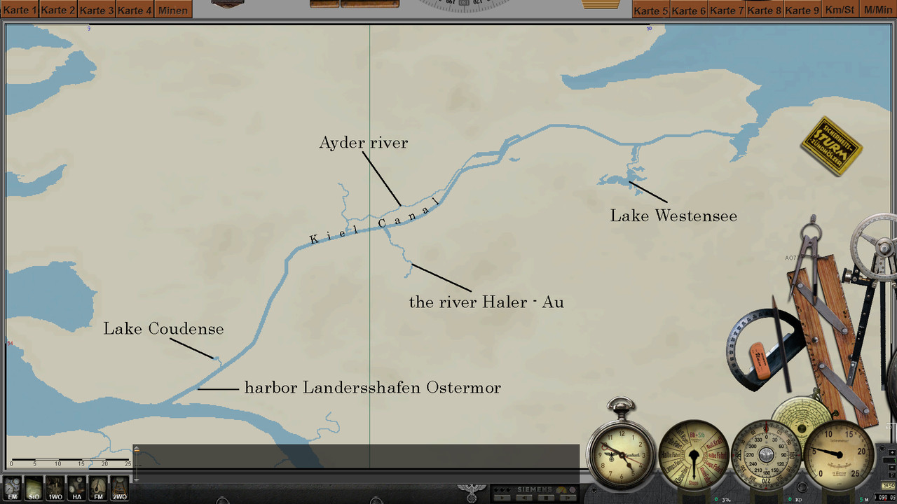 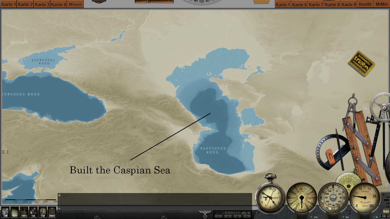 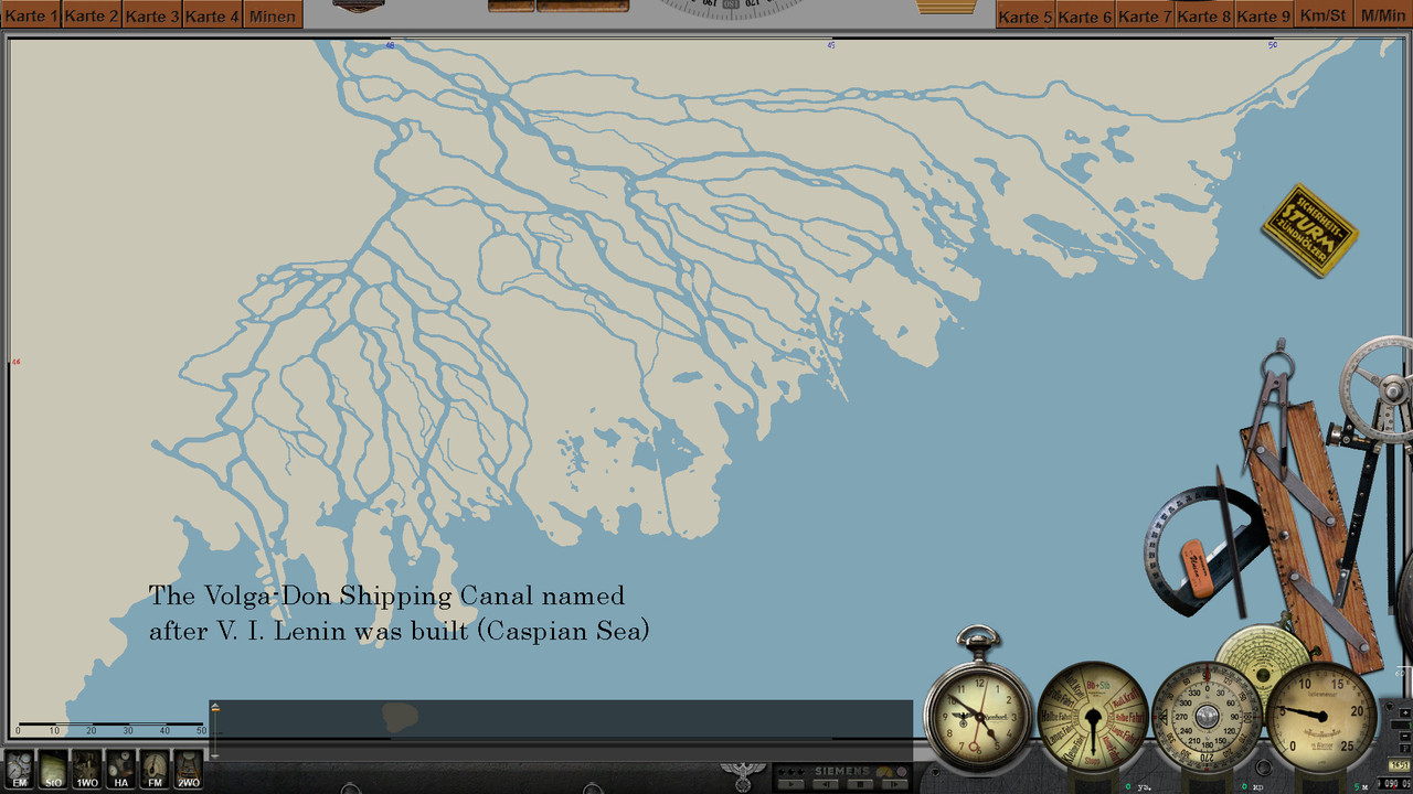 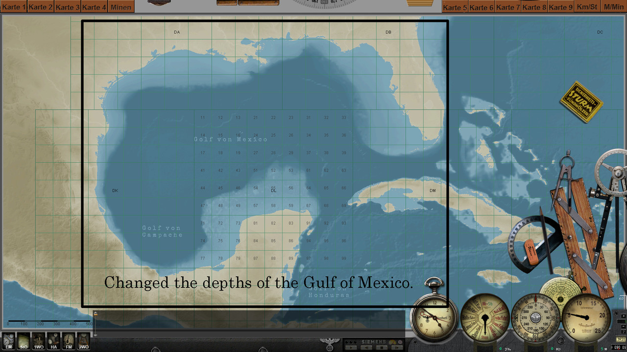 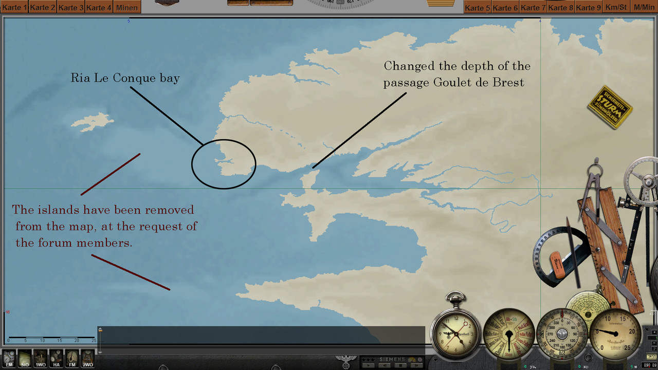 ----------------------------------------------------------- Navigation Bathymetry Map 2022 (Stock version Final) Download: https://www.subsim.com/radioroom/sho...d.php?t=252093 -------------------------------------------------------------- Navigation Bathymetry Map 2022 (SH2 version Final) Download: https://www.subsim.com/radioroom/sho...d.php?t=250315 --------------------------------------------------------------- Navigation Map (Physical map Final) Download: https://www.subsim.com/radioroom/sho...d.php?t=252133 ----------------------------------------------------------------- NavMap SH3 (Experience) 07.08.2022 All updates from previous mods are present in this mod. The main difference is that now every person who has downloaded this map will be able to change the colors in it at his own discretion. There are six positions that can be changed: 1 - color of names of bays and cans. 2 - color of grid numbers. 3 - coordinate grid color. 4 - color of country names and color of continent names on a long distance map. 5 - color of country borders. 6 - the color of the names of the seas and oceans and the color of the oceans on the map far scale. Inside this mod is an instruction in Russian and English. (I wrote the English instruction using Google translator, but I hope the presence of images will make it easier to read) 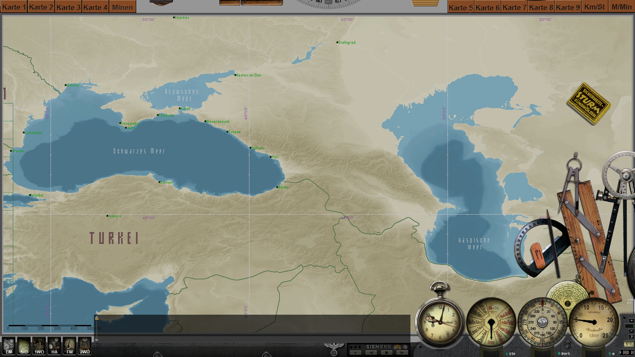  Download: https://drive.google.com/file/d/1IQI...ew?usp=sharing Last edited by astvitaliy1982; 09-09-22 at 01:01 PM. |

|

|
|
|


 Threaded Mode