
|
|
SUBSIM: The Web's #1 resource for all submarine & naval simulations since 1997
|
SUBSIM: The Web's #1 resource for all submarine & naval simulations since 1997 |
|
|||||||||
 |
|
|
Thread Tools | Display Modes |
|
|
 06-15-22, 03:36 PM
|
#1 |
|
Lieutenant
 Join Date: Jun 2019
Posts: 257
Downloads: 550
Uploads: 0
|
Navigation Bathymetry Map 27.08.2022
1. The Archipelago of Saints Peter and Paul has been added to the map. 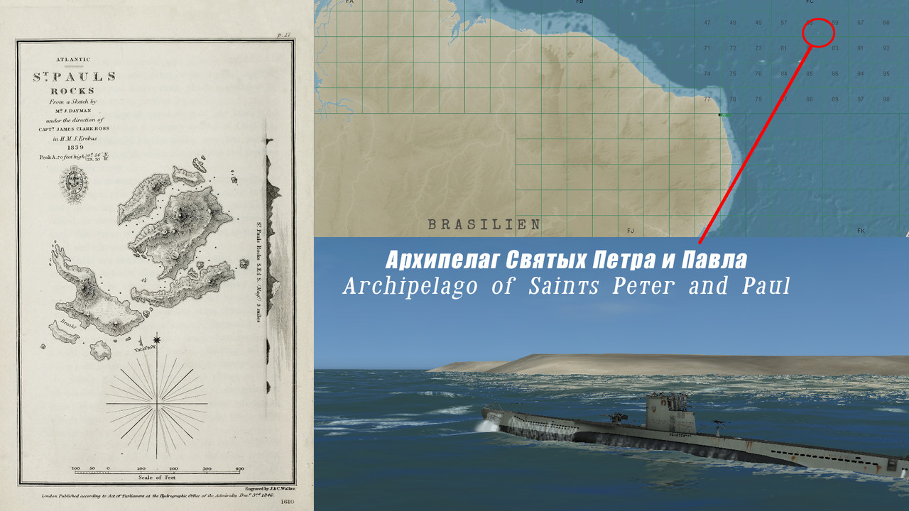 2. Orinoco and Amazon have been added to the map. 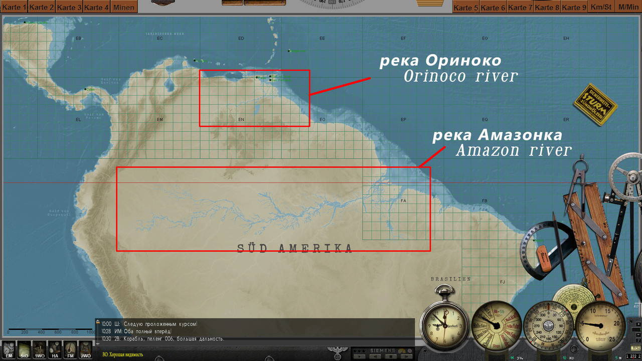 3. The River Thames has been added to the map. 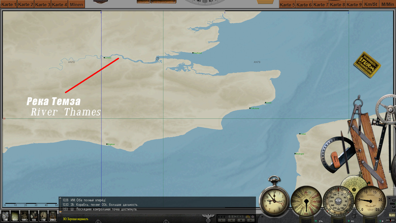 4. The island of Sula Sgeir has been added to the map, as well as the heights of the island of Rhone have been redone. 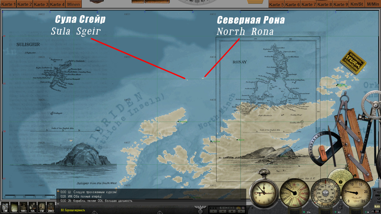 5. Tjeldoya Slott Skerry Pass has been redesigned. Reworked depths in the Narvik and Harstad areas. 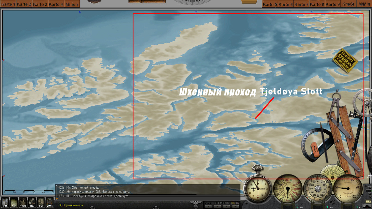 ----------------------------------------------------------- Navigation Bathymetry Map 2022 (Stock version Final) Download: https://www.subsim.com/radioroom/sho...d.php?t=252093 -------------------------------------------------------------- Navigation Bathymetry Map 2022 (SH2 version Final) Download: https://www.subsim.com/radioroom/sho...d.php?t=250315 --------------------------------------------------------------- Navigation Map (Physical map Final) Download: https://www.subsim.com/radioroom/sho...d.php?t=252133 --------------------------------------------------------------- Navigation Bathymetry Map 03.08.2022 The final version of the mod. Additions: The depths of the Gulf of Mexico have been redone, the Caspian Sea has been added to the game, the Volga-Don navigable canal (Caspian Sea) was built, the Kiel Canal was improved, in the Brest area, the Goulet-le-Brest passage was built, the Ria-le-Conque bay was built. In general, the Brest area has been improved, islands built in an earlier version have been removed from the map. fashion. Scroll down this page. Added one more map - NavMap SH3 (Experience) 08/07/2022 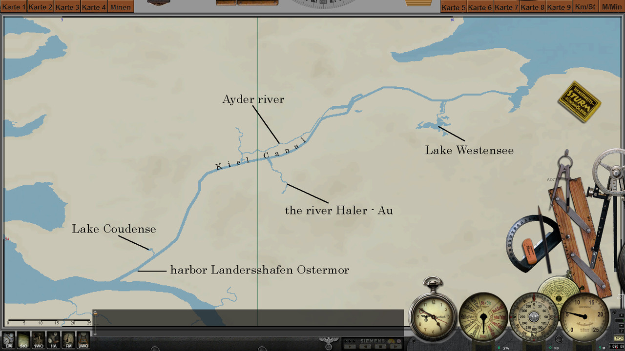 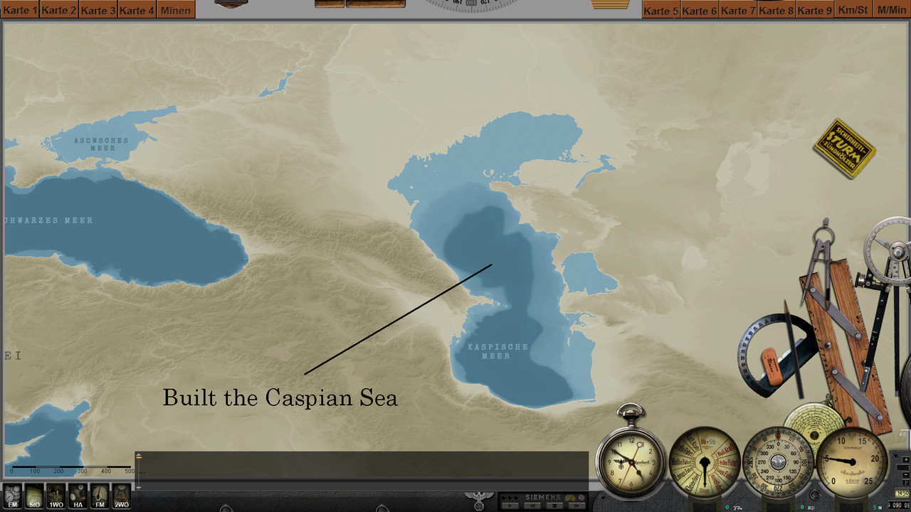 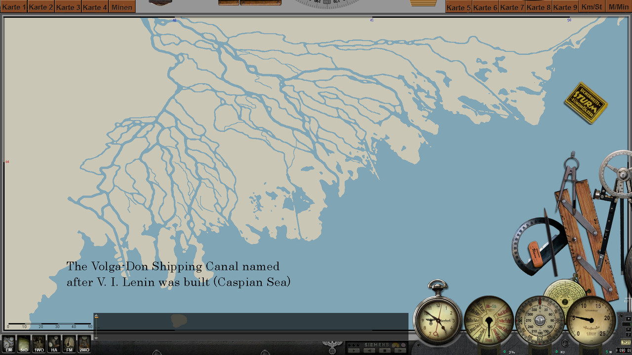 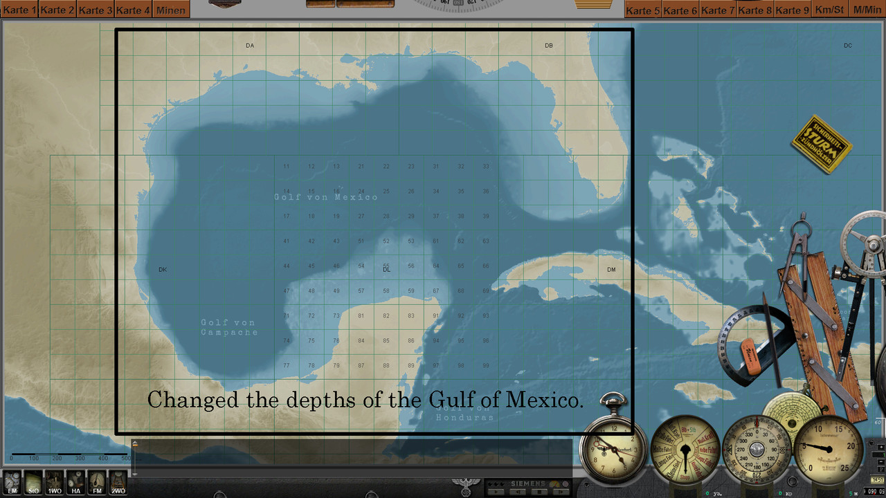 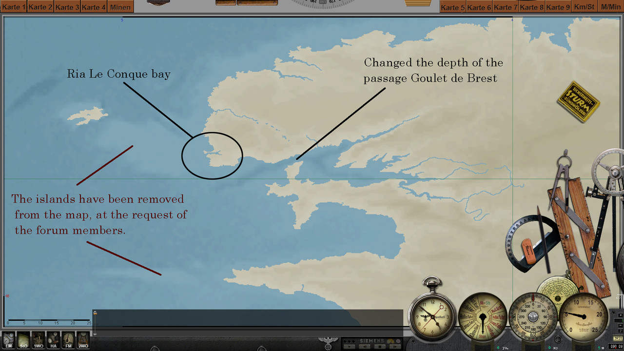 ----------------------------------------------------------- Navigation Bathymetry Map 2022 (Stock version Final) Download: https://www.subsim.com/radioroom/sho...d.php?t=252093 -------------------------------------------------------------- Navigation Bathymetry Map 2022 (SH2 version Final) Download: https://www.subsim.com/radioroom/sho...d.php?t=250315 --------------------------------------------------------------- Navigation Map (Physical map Final) Download: https://www.subsim.com/radioroom/sho...d.php?t=252133 ----------------------------------------------------------------- NavMap SH3 (Experience) 07.08.2022 All updates from previous mods are present in this mod. The main difference is that now every person who has downloaded this map will be able to change the colors in it at his own discretion. There are six positions that can be changed: 1 - color of names of bays and cans. 2 - color of grid numbers. 3 - coordinate grid color. 4 - color of country names and color of continent names on a long distance map. 5 - color of country borders. 6 - the color of the names of the seas and oceans and the color of the oceans on the map far scale. Inside this mod is an instruction in Russian and English. (I wrote the English instruction using Google translator, but I hope the presence of images will make it easier to read) 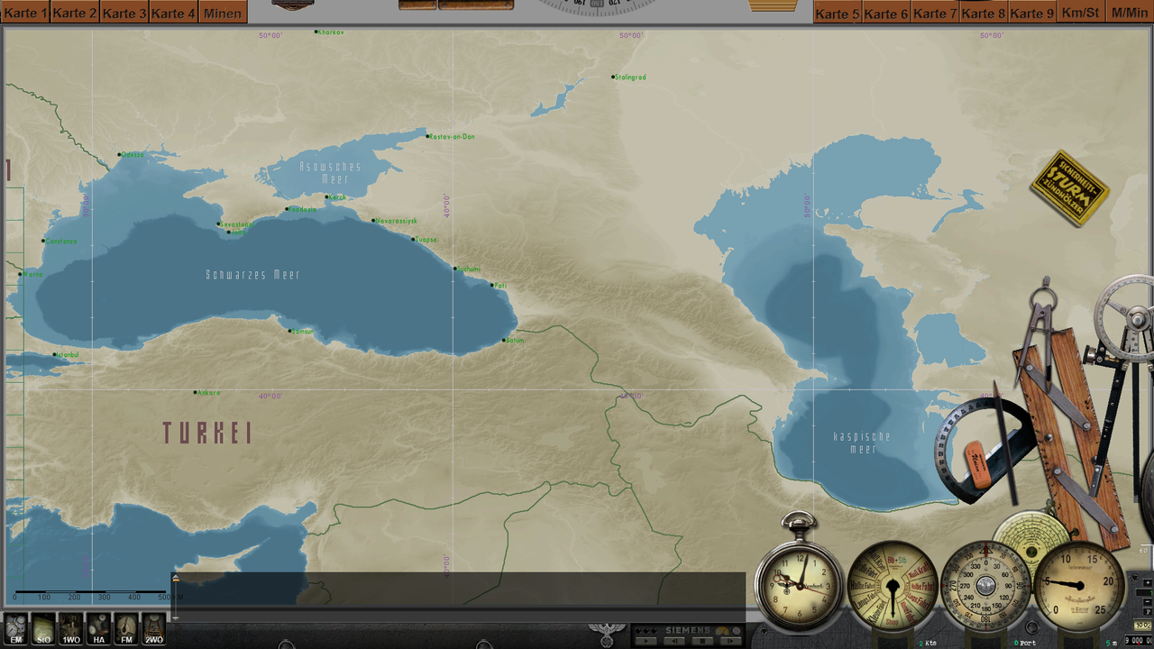 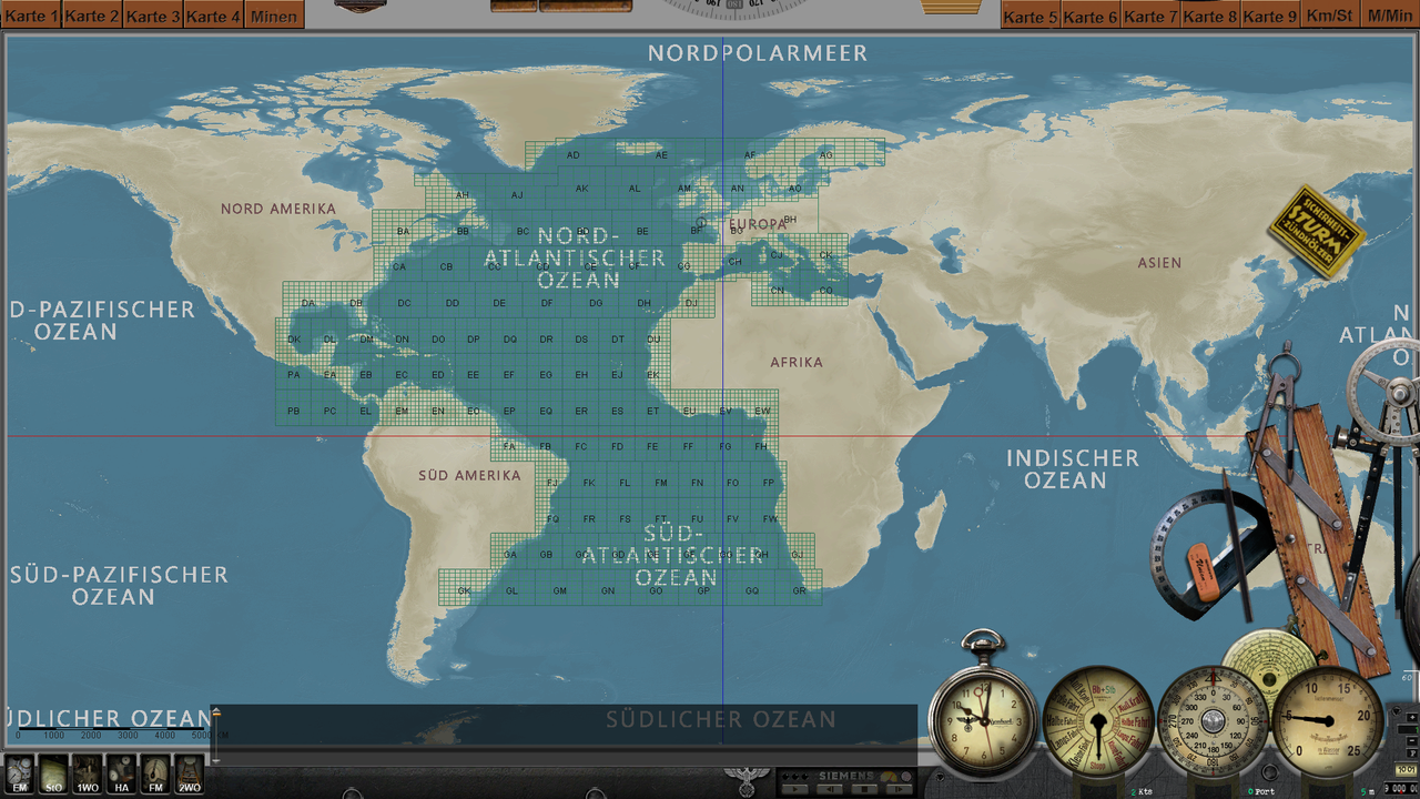 Download: https://drive.google.com/file/d/1IQI...ew?usp=sharing Last edited by astvitaliy1982; 09-09-22 at 01:01 PM. |

|

|
|
06-15-22, 04:00 PM
|
#2 |
|
Ocean Warrior
 Join Date: May 2012
Location: In the sea, on land and above
Posts: 3,350
Downloads: 848
Uploads: 0
|

__________________
  |
|
|
|
|
06-15-22, 04:20 PM
|
#3 |
|
Sea Lord
 
Join Date: Jan 2017
Location: France Nord East
Posts: 1,672
Downloads: 817
Uploads: 0
|
good evening friends
I wanted to put here the work of astvitaliy1982... I want to say that it is really remarkable and that from the beginning that you have approached this theme... I really like the details.. the precision.. that you bring and it keeps getting better. Thank you to all those who help and contribute to make this possible (Jeff.. Anvart..etc) I can already hear the criticisms: I quote "yes but the Krieg marine didn't have this kind of map..." we don't care.." this can help during certain dangerous navigation passages.. screens:    PS : don't wait download this pearl friends |
|
|
|
|
07-25-22, 12:10 PM
|
#4 | |
|
CTD - it's not just a job

Join Date: May 2016
Location: One hour from Music City USA!
Posts: 9,762
Downloads: 441
Uploads: 2


|
Quote:
 aka: CTD - Compulsive Tweaking Disorder, astvitaliy1982... although, I would argue the use of the word "Disorder" there... "Disease" maybe? contagious? Most likely... lol ;^) aka: CTD - Compulsive Tweaking Disorder, astvitaliy1982... although, I would argue the use of the word "Disorder" there... "Disease" maybe? contagious? Most likely... lol ;^)
__________________
   |
|
|
|
|
|
07-25-22, 03:43 PM
|
#5 |
|
Commander
 Join Date: Sep 2011
Location: Halifax, Nova Scotia THE HUB OF ALL CONVOYS
Posts: 461
Downloads: 368
Uploads: 0
|
This is a really nice mod and I would really like to use it but I can't use it with the Onealex mod for the fact that some of the new islands you made, namely the ones outside of Brest has ships running into them because you would need to edit all the traffic paths in the .RND campaign file and the .SCR campaign file and that's way too much work for someone such as myself to do. Maybe if you play with Onealex's mod you can look at the paths the ships takes in mission editor and change them or place the French islands outside of Brest in such a way that traffic goes between them. But simply placing new land masses is fine if your able to ensure ship traffic routes is not affected.
Something you should look into maybe as future work on this mod 
__________________
U-Boote sind die Wölfe auf See...Angreifen...Reißen...Sinken!!! U-boats are the wolves at sea...Attack...Tear...Sink!!! - Karl Doenitz  Admin for the Onealex Mod Discord - https://discord.gg/bKCdQekE4W https://www.youtube.com/watch?v=tSpRvfqFYp0&t |
|
|
|
|
07-25-22, 06:55 PM
|
#6 |
|
Expert Shipsinker

 Join Date: Feb 2007
Location: Baltimore,Md./ CA45
Posts: 805
Downloads: 360
Uploads: 0
|
Can't use the "Navigation Map (Physical map Final)" with the new Toyotagt86 v2.2. I really like that map too. But I'm sure an updated map will be along shortly. So no problem.
__________________
ONEALEX 1.53 ARB / NYGM Enhanced "Steel Coffin" v5.8 DGUI / CCom12 DGUI / WAC 5.2 DGUI / Toyotagt86 v2.3 ARB / GWX3 DGUI |
|
|
|
|
|
|


 Hybrid Mode
