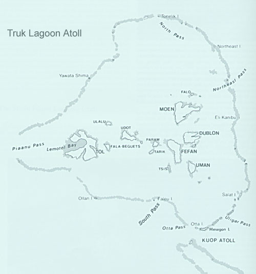
Where you go depends upon where the convoy comes from and goes to... Here is an acceptable map of Truk Atoll:
and an acceptable map of the area, including supposed shipping routes:
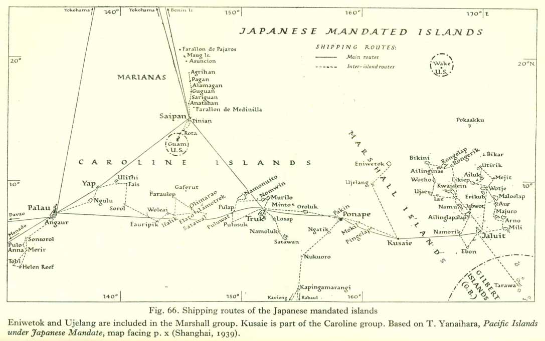
Note that shipping routes were in a constant state of flux from mid-1943 to the end of the war. But traffic might come done from Japan along the Bonin / Volcano lines to the Mariannas, and then diagonally to Truk, and from thence to Ponape and the Marshalls. What is NOT shown is the eventual major route to Kavieng and Rabaul for distribution to the Solomons or New Guinea. Traffic from Japan or the Philippines might also come from the Palau side directly to Truk for further distribution. This is "historical" information...
One thing to remember about the SH4 game itself, and this includes Stock, with TMO, RFB and RSRDC, as well as other mods, is that Truk is not represented well enough to reliably run ships through the Atoll, due to the way the ships are actually rendered and operate in the game, and due to the inaccurate way the game renders land and sea. Therefore, anything originating or terminating in the atoll has a tendency to get "stuck" and/or go into collision avoidance routines and act very strangely. Here is the Stock game, which would also be with RFB, with the "white" water being shallows:

btw - Stock has minimal traffic in or near Truk... Here is the 43a Merchant layer as found in TMO. Note, same terrain map as Stock...

and here is the 43aMerchant and Convoy layers merged together as found in RSRDC:

Going out the south, or inbound, they are to/from Kavieng/Rabaul. Going out the west opening, they are usually headed for Palau, but might also head for Saipan. Some traffic will come in from the north also, but in different files, different years... It is of course, much much easier to find traffic when between two points on a known traffic route than it is to be close to the origination or destination, which makes it difficult to know which entrance at Truk a given group would use. Remember, there was usually 5 or 6 US boats assigned various areas around Truk at any given time, and your job would have been to be astraddle one certain route. Same with the Marianna Islands, or any other location from about mid-1943 for the duration. Now, early in the war, the US was just as bad as anyone else in "prosecuting" the war, and they would generally try to hang-out around harbors, where there was local planes and ASW ships, as well as group escorts to contend with...
